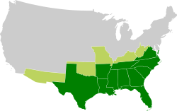
The next map is a map of the Confederacy during the Civil War and States and territories claimed by CSA without formal secession and/or control.

The last map is the 2008 Electoral Map. Montana is shown blue but was actually red and switch Missouri and North Carolina's colors.

Interesting.
No comments:
Post a Comment